
Filter - control incident types displayed on map.
Zoom to your location
Reset map zoom and position
Show Legend
Unit Information
650 Wolfpack Way
Kalispell,
Montana
59901
Agency Name: U.S. Forest Service
Agency Abbreviation
FS
650 Wolfpack Way
Kalispell,
Montana
59901
Agency Name: U.S. Forest Service
Agency Abbreviation
FS
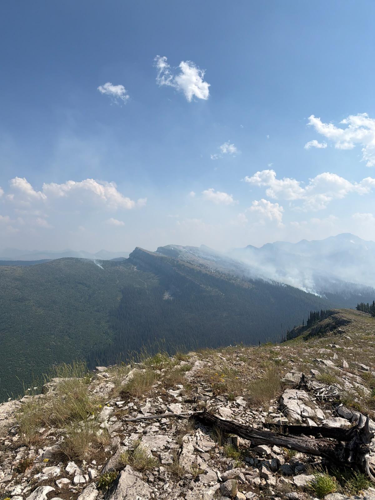
The Silvertip Fire was started by lightning in the Spotted Bear Ranger District of the Flathead National Forest, approximately 15 miles southeast of Spotted Bear Ranger Station, near Silvertip Mountain. The fire was detected by aircraft on July 24, 2026 while conducting recon on another reported fire. The fire is burning in heavy timber on steep slopes with standing dead and down trees.
A Forest Closure is in place for several trails in the fire area for public and firefighter safety: https://www.fs.usda.gov/r01/flathead/alerts
| Current as of | Thu, 07/30/2026 - 22:46 |
|---|---|
| Incident Time Zone | Mountain Standard Time |
| Incident Type | Wildfire |
| Date of Origin | |
| Incident Time Zone | Mountain Standard Time |
| Coordinates |
47° 50' 8'' Latitude
-113° 16' 25 '' Longitude |
| Size | 4,142 Acres |
|---|---|
| Significant Events | Observed fire behavior is moderate with creeping and isolated tree torching. |
| Weather Concerns | Conditions remain hot and dry with low elevation humidity frequently dropping into the teens. Ridges will have winds gusting around 20 mph at times, with increased sustained wind and strong gusts predicted over the weekend. |
|---|